Warsaw Chopin Airport (WAW)
Orientation and Maps
(Warsaw, Poland)
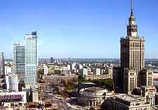
Poland's biggest and most important city, Warsaw is also the capital.
Situated alongside the Vistula River, Warsaw has a population of around 1.7 million residents and is full of cultural attractions, including more than 30 different theatres, a large convention centre and a number of university buildings.
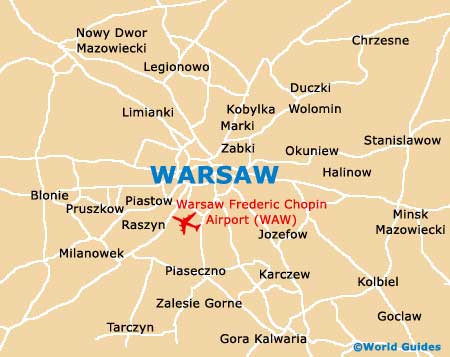
To the south-west of central Warsaw, Chopin Airport (WAW) is Poland's premier airport and regularly serves many millions of passengers each year. Within the city of Warsaw, public transport is good and popular options include streetcars / trams, a metro rail system and buses, with almost 200 different bus routes in place.
Warsaw Chopin Airport (WAW) Maps: Important City Districts
The city of Warsaw features 18 different boroughs, known locally as 'dzielnica'. Containing their own individual communities and neighbourhoods, the city's main borough is Mokotów, which is full of spacious parklands and landscaped areas of green. Warsaw's Mokotów borough has a population of around 230,000 and covers more than 35 square kilometres / 14 square miles.
Other large and noteworthy districts around the city include Praga Poludnie, Ursynów, Wola, Bielany and also Sródmiescie, which is home to the city's popular Old Town and New Town districts. Highlights in the Old Town area include the red-brick Royal Castle and the adjacent Zygmunt's Column, a historic landmark dating back to the middle of the 17th century. Nearby, the Saxon Garden (Ogród Saski) is amongst Warsaw's most historical parklands and features landscaped, English-style gardens.
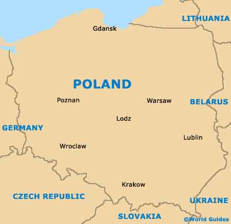
Poland Map
Warsaw Map